
The Naughty Maps of ESRI 2009
Last week I ended up at the ESRI 2009 Conference in San Diego. It's one of the larger annual Geographic Information Systems conferences. Basically, if you want to know where something is, or if you want to tell other people where things are, and I mean, like, really, seriously let them where the fuck they, or the things they desire, are, with maps and charts and graphs and lasers and hand waving and so on, this is (one of) the conference(s) you go to.
One of the more interesting portions of the conference (since I couldn't actually go to any of the talks, damn expo only badge) was the map gallery on the top floor. Rows and rows and rows of informatics porn. Maps about things you care about, things you don't care about, things you haven't heard of, things you didn't expect (pirates and what looks to be the worst game of SimAnt EVER, for instance). Took me over an hour to get through it, and by the end I could no longer process numbers, graphics, or geography. It was awesome.
Now, if you'd asked me before hand if I thought I'd get a slashdong post out of this visit, I would've laughed at you. In fact, I'm laughing as I write this. But, sure enough, there were a couple of maps that actually stood out.
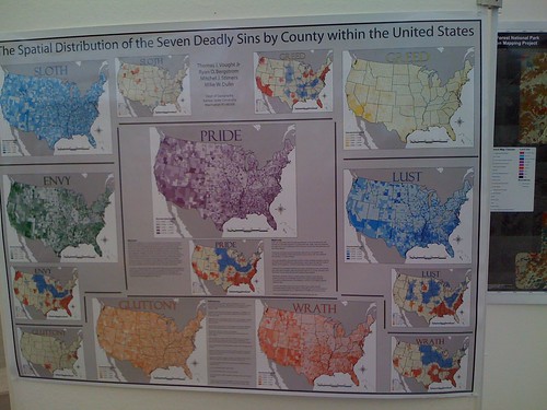
The Spatial Distribution of the Seven Deadly Sins by County within the United States was the first one that made me do a double take. This map establishes different metrics for sins, such as per capita density of fast food restaurants for gluttony...
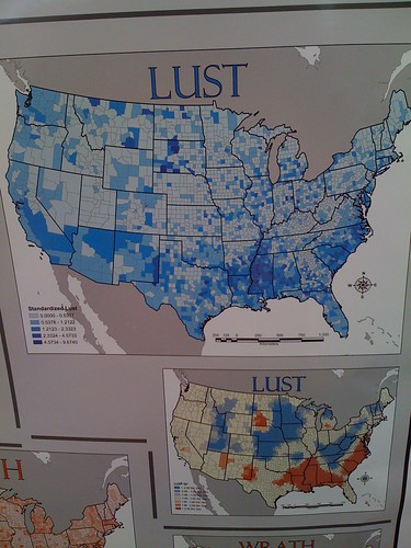
Or occurances of sexually transmitted diseases for lust. Really, just the fact that the legend has a header of "Standardized Lust" makes this one of the best pieces of information graphics I've ever seen.
For more information on this map: Las Vegas Sun Article Chart Porn - No. Seriously. Chart Porn. This is getting a sidebar link as soon as I have sidebar links again.
Onto the next map...
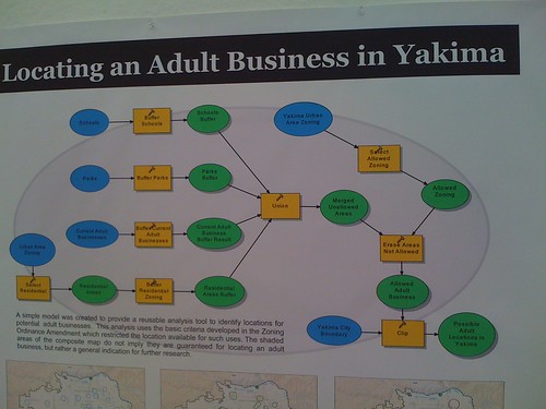
Say you live in Yakima, Washington. You've got pornography, possibly some adult toys, and maybe a few naughty board games for couples looking to spice up their relationship. You know that somewhere in Yakima, someone else has cash, and is ready to give it to you in trade for these goods (but not services, as this is Washington, not Nevada). How can you know where to place your business so that you can maximize profit while minimizing neighborhood backlash? Time to fire up ArcGIS and get mappin'!
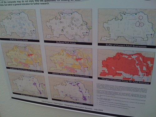
This map takes into account proper buffer zones around areas that would not be acceptable (parks, schools, residentially zoned land), as well as creating larger buffer zones around places where stores already exist. It uses this data to create viable business spaces with in the city limits of Yakima.
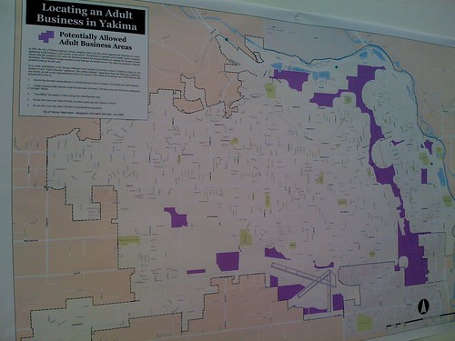
In the end, you get a small strip of land down the eastern side, following what I believe is North 1st Street, as well as some slightly random places right around the western edge of airport (South 36th Ave). Great for rooftop advertising to weary, horny travelers!
All in all, I learned quite a bit at this conference. There'll be more stories over on Nonpolynomial Labs in the next couple of days, so keep an eye out there for the non-sex stuff (but it'll involve missles AND rockets at the same time!)
